Pendeen Lighthouse, also known as Pendeen Watch.
That’s the thing with doing nothing, you don’t really know when you’re finished. But we’re finally back on the road after being stuck in Wimbledon during the winter months.
This last week of April we went to the part of Cornwall called Land’s End on the Penwith peninsula, a plateau formed from a huge mass of granite that squeezed like hot paste into the surrounding sedimentary rocks. It’s mainland Britain’s most south-westerly point, although many Cornish people will say that Cornwall is not England!
And you should absolutely avoid Land’s End at any cost 🙂 Why? Well mainly because it’s a very famous landmark, being promoted as a “tourist and holiday complex” Over 500,000 people visit Land’s End each year.
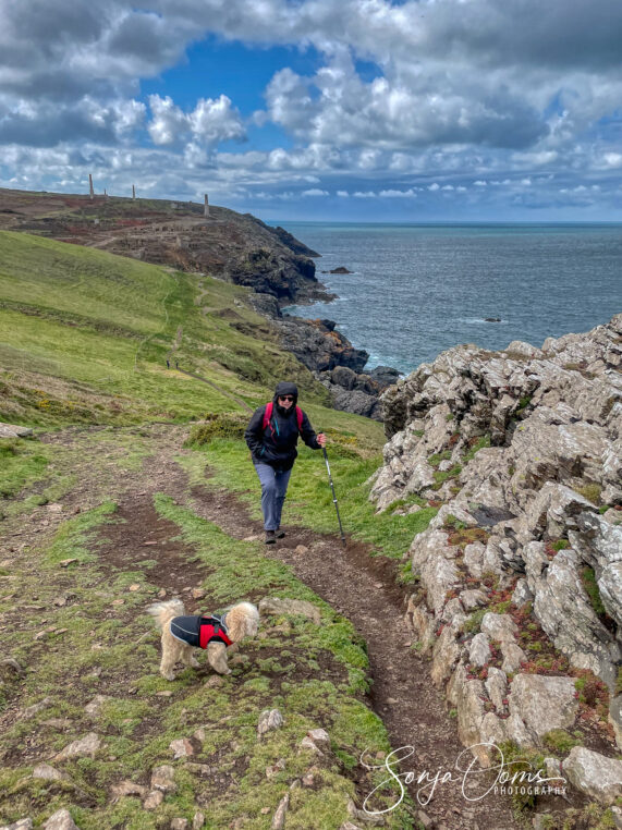
Instead we decided to head for a place 10 miles away from Land’s End along the South West Coast Path: Pendeen. Much quieter and more suited to our taste: wild, rugged coastlines, unspoiled by tourists and instagrammers. Spectacular coastal paths connect the settlements along this section of Cornish coastline, taking in some of the most stunning scenery in Cornwall, and even at the height of summer, it is very quiet. Nearly 40 miles of continuous, unbroken sea cliffs are waiting for you. With fine sand beaches washed into narrow cuts, and water the deep turquoise of the Bahamas. At least when the sun is out that is, remember this is still the UK 🙂
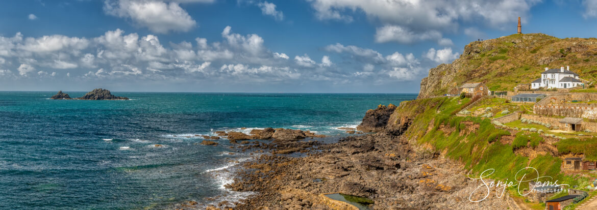
Cape Cornwall
Penwith’s most stunning cliff scenery comes together at Cape Cornwall. Once thought to be the most southwesterly point in England. The scenery is extraordinary, even for Penwith. At the top of the headland is a striking brick chimney, part of a tin mine which closed in the 1870s. The views from it are magnificent.
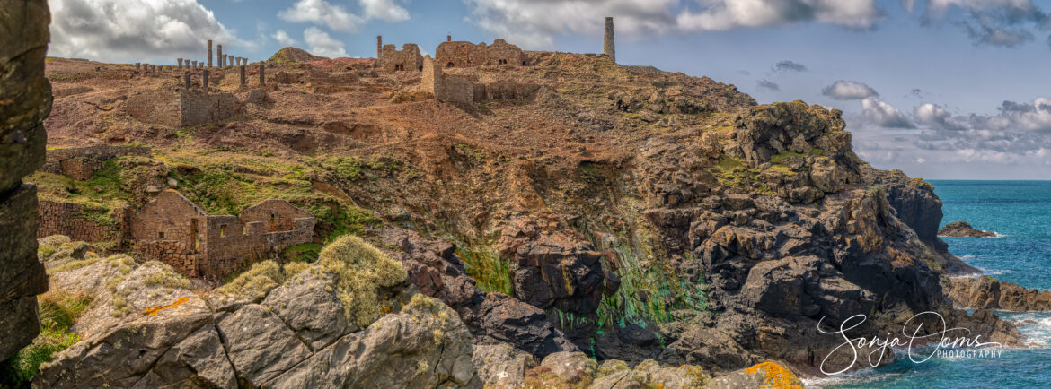
Ruins of the Greevor Tin Mine
That chimney marks more than good views. It’s also the southern end of nearly five miles of cliff-top chimneys, engine housings, mine shafts, even entire factory foundations, all abandoned, all in ruins — relics of the last era of Cornwall’s famous tin mining. Here is where tin formed, precipitating out of magmatic gases and fluids that rose in veins along the near-vertical bedding planes between layers.
The five-mile coastal walk through this area, is a great experience. The wild cliffs are brilliantly offset by the scars of abandoned industry. Sea thrifts colonize the once barren ground, giving a gorgeous display of great pink mounds in May and June. The ruins themselves are fascinating and often beautiful, dating as they do from an era of hand-cast locally produced brick, put up by artisan masons.
By the end of the ’80ies mines started closing. Owners switching off the giant pumps that ran day and night, evacuating millions of gallons of water a day out of the tunnels. The last mine was closed in 1998.
Trengwainton Garden
While in the neighborhood, a must visit is another one of the many National Trust jewels: Trengwainton Garden. Perhaps the best for exotic trees and shrubs, including tree ferns. But many other species flourish in the unusually mild climate, a flower lovers’ paradise. Great collection of magnolias, and camellias with a series of walled gardens and a stream garden alongside the drive bordered by beechwood.
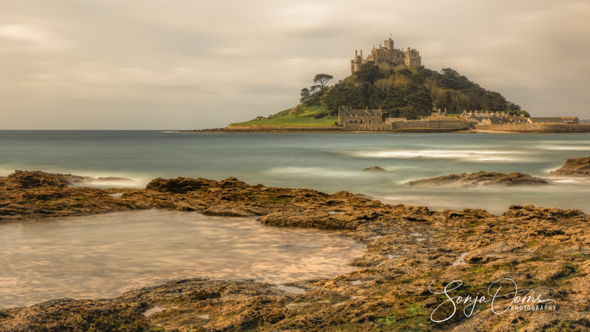
St Michael’s Mount
St Michael’s Mount is a tidal island and is linked to the town of Marazion by a causeway, passable only at low tide. The castle and chapel have been the home of the St Aubyn family since around 1650. Historically, St Michael’s Mount was the counterpart – same characteristics – of the much larger Mont-Saint-Michel in Normandy, France.
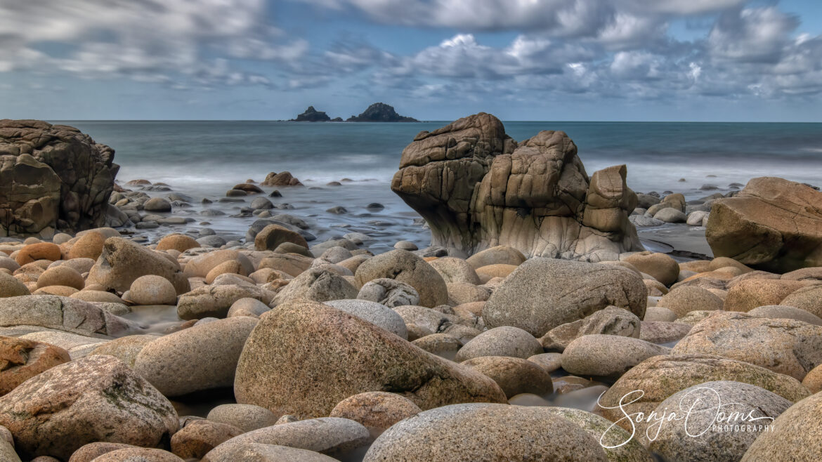
Porth Nanven aka ‘Dinosaur Egg Beach‘
Porth Nanven is also known as ‘Dinosaur Egg Beach‘ because of a remarkable deposit of ovoid boulders covering the beach. These boulders come in all sizes, from hen’s egg to a metre or more, and have proved so tempting as souvenirs that they are now legally protected by the National Trust, owner of the beach.
Many visitors assume that these boulders are the work of the sea, which they are. But a sea of 120.000 years ago. Sea levels were much higher then – mainly due of course to the very polluting cars of our Neanderthal ancestors. Causing the ancient beach to be suspended in the cliff about 30 or more yards above the present level. Stand on the beach and look back towards the cliff, and you will see a wall of the rounded rocks waiting to break away and join those on the beach today.
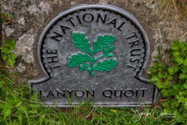
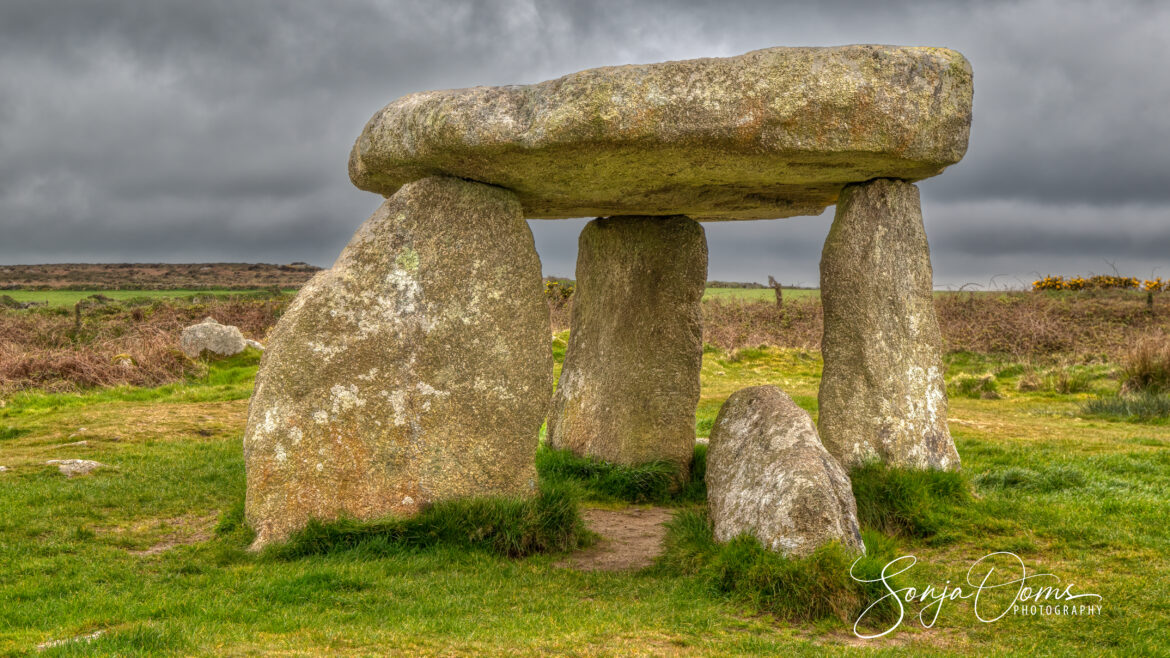
Dolmens (locally called quoits) remain from the earliest times—strange structures of standing stones, capped by a giant flat rock, thought to have been the centers of burial chambers whose mounds have long since disappeared.
Unfortunately we had to cut short this trip because of the weather. And to add insult to injury, the next trip to Snowdonia was completely cancelled because of a nasty viral infection. In the planning now is a trip to Skomer Island and its famous colony of puffins. Watch this space!